But anyway, due to a rota-related cock-up by my idiotic co-worker (who shall, of course, remain nameless) I had an unexpected Monday off yesterday, so I decided to put it to good use. After a hearty feast of a McDonalds sausage & egg McMuffin, I got the 08:45 bus to Middlesbrough. I like travelling before 9am, as it means there are no freeloading pensioners cluttering the place up with shopping trollies, small well-behaved dogs, and knitting. Perhaps the knitting is an exaggeration, but you get the idea.
I arrived in the 'Boro, and had just under an hour free before my train to Marton was due to depart. Luckily I had a trusty ancient map with me, so easily navigated my way to the nearest walkable abandoned station; Newport. I headed out of the bus station, and immediately lost myself in a maze of factories and chemical works, belching toxic fumes... Except it was nothing like that! It was like a normal town - clean air, ordinary shops, trees that weren't dead - it looked a bit like parts of Exeter. I was quite disappointed.
I found Newport station. Or more to the point, I didn't, 'cos it's not there any more. It closed in 1912, and there's no obvious evidence it was ever there. There are still tracks through the site, it being on the main line west of Middlesbrough, but the only notable feature is now the Newport bridge, over the Tees, which I didn't expect to be painted red.
 |
| Newport |
Middlesbrough station forecourt is currently undergoing building work, so I had to follow the road a fair way round before I could find an entrance that was actually open, and run up a flight of stairs. There was a queue at the booking office windows, and while I was trying to locate the curiously invisible ticket machine, I saw my train trundling away. No matter - I could nip across the river, and have look at the Port Clarence branch.
| Gutted! |
But no! Once again, the gods were not in my favour - who would have thought that in the 21st century, a piece of transport infrastructure, in a city, closes for lunch? This isn't Spain!
Oh well, Port Clarence and Haverton Hill can wait 'til another time - maybe I'll drag Gotho along and combine it with a trip to the Institute of Modern Art, or perhaps Primark.
I headed back to Middlesbrough station, through a slightly unsettling landscape. It's a bit like somebody has started building a model town, and bought a few public buildings, such as a bank, and a church, but then run out of cash, covered the gaps in scenic scatter, and chucked some horses about in the hope nobody would notice. Very odd.
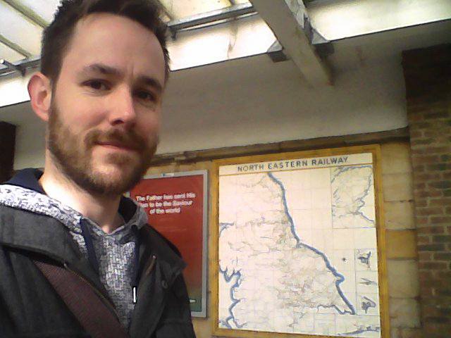
I had half an hour or so to wait before the next train, so I had time to admire the interior decor. It reminds me quite a bit of St Pancras, circa 1997 before it got all Eurostarified. It's all dark wood, pointy arches and mock Tudor panelling. They've even made WHSmiths look quite attractive. The subway is nice too - like a medieval crypt - but sadly the platforms themselves are not. Unfortunately, Middlesbrough station roof was smashed to bits by the Luftwaffe in 1942, and the 1950s replacement canopies are just naff. They're all stained concrete and plastic light fittings.
 |
| Middlesbrough |
"Marton?", I hear you cry, "What is this Marton?" Indeed, there is no Marton on the map. Until 1982 it was called Ormesby, but the powers that be decided to change it. Not entirely sure why - Ormesby Hall is right next door, so I think they're missing a trick. Apart from the name confusion, there isn't really much else to say about the place - it's just a small leafy halt, with quite a rural feel considering it's only 8 minutes from the town centre.
 |
| Ormesby. That's what the map calls it, and so shall I. |
Certainly nobody uses my next destination, or at least not nowadays, but more anon... I walked down the ramp, turned under the station bridge and strode out along the main road. Ormesby Hall grounds were to my right, and pleasantly dull suburban houses to my left. I passed a parade of shops, which were open and inviting-looking. There were no boarded up houses, no stolen cars in flames - clearly my idea of suburban Teesside was false. How very disappointing!
So back to stations, or in this case, lack-of. The Eston branch line closed to passengers way back in 1929, so apart from a line of grass, there's very little left to be seen. The station site - conveniently located on Station Road (so imaginative) - is marked by a line of trees, and seems to be the official dog shitting area for the whole of Cleveland.Suppose they have to do it somewhere though...
 |
| Eston. I think I was listening to Simon & Garfunkel, if you're interested. |
I'd actually been quite worried about this part of the walk - Grangetown - expecting at least some mild taunting from hordes of feral teenage chav, but I was mistaken. There was virtually no-one around; I saw one guy who appeared to be painting the inside of his car engine (is this a normal thing to do?), and a guy in a camo jacket looking sad, but apart from that I was alone on the footpaths.
There was heavy traffic on the road leading to Eston Grange station (renamed after the Big Tile Map as Grangetown) as it is also the main route to the docks at Teesport (Note to self - that would be a good name for a golf shop), but no pedestrians, despite the oddly broad pavement. The station closed in 1990. The line is still open towards Saltburn, and there's still a large signalbox surveying the scene. The closest I could get to the old platform was by standing on a set of steps over a large pipe - what it carries, I know not - part of "The Teesdale Way"...
 |
| Eston Grange: Unknown chemicals beneath my feet |

I retraced my steps for half a mile or so, and then turned onto a dual carriageway - maybe the A66? I'm not entirely sure; trunk roads always look a bit samey to me - alongside an industrial estate, and it started to drizzle. The rain got heavier, as I passed "The Tyre Station", a yard full of shipping containers, and a bus graveyard, before arriving at the bleak and windswept South Bank.
Now, you may be wondering why the picture to the right hasn't got my big potato face in it, despite South Bank station being on the Big Tile Map. Fear not - there is a reason. The current South Bank station only opened in 1984, replacing another South Bank station in a different location, a few hundred yards further east. Luckily for me, the Teesdale Way runs right next to the line from this point - and is actually open - and consequently I was able to take a picture of myself in the "correct" place.
 |
| South Bank: Look how happy I am |
After around a mile, the road veers off, and my route crossed a small bridge over what may have been a drainage ditch, or maybe a small canal. It was surprisingly peaceful - like a rural towpath - there were trees getting their first leaves of spring, and a family of ducks sailed by. Soon I was at my last station of the day - Cargo Fleet - which closed in 1990, and like the previous two, has been almost totally levelled. I took a photo at approximately the site of the entrance to the platforms.
It seemed odd that a station which has closed so recently can have vanished so completely, then I remembered that 1990 is actually 27 years ago, and thus isn't actually very recent at all. Time is a very scary thing.
 |
| Cargo Fleet |

From there, it was only about a mile back to the bus station, but it was still quite an interesting stroll. By what was the station forecourt entrance, there's still a fine old signal box by the level crossing, some tramway-type track set into the road past the pub - The Navigation Inn ("Sorry no away supporters"), and an attractive, but derelict, house which looks vaguely connected to the railway. Maybe the stationmaster lived there, or a crossing keeper? I'd have loved to have looked inside, but alas all the windows and doors have been sealed up with breezeblocks.
And that was it for the day - just time to buy a sausage and cheese turnover from the bakery on the bus station before getting the 16:20 back towards home. After all those miles of legwork, the cheap leatherette seats of the Arrive 93 have never felt comfier...
Well worth the wait! Hurrah for the continuing adventures of the PlatformCat!
ReplyDelete